RealityCapture and UAS survey
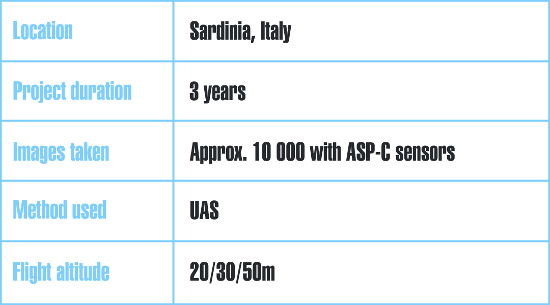
UAS photogrammetry survey: Landscape assessment of an abandoned quarry in Sardinia, Italy.
The Italian National Research Council (CNR) is the largest public research institution in Italy, the only one under the Research Ministry performing multidisciplinary activities.
Currently the CNR Institute of Environmental Geology and Geoengineering (IGAG) - Cagliari Department, is particularly involved in developing new methodologies for proximity remote sensing.
The aim is to obtain detailed 3D maps and 3D models with the use of suitable UAS systems and aerial photogrammetry survey in hazardous areas that are difficult to access. The goal of their activity is aimed at creating documentation of structures and buildings which are of historical interest and located within the mine areas. Another goal is to create documentation of archaeological sites and monuments, and perform environmental and landscape research.
Project
The subject of their recent research project was an abandoned mine located in Sardinia, Italy. The whole project was based on UAS (unmanned aerial system) survey in order to achieve detailed 3D photogrammetric and BIM models of the abandoned mine.
The main focus was on the evaluation of the landscape management degradation which is often very complicated due to the complexity of landforms in open-pit areas. The results of the research project could then be applied to other similar sites.
In this area, the quarrying activity has a long tradition, with extensive outcrops of argillized volcanics exploited for kaolin. Within the quarry it is possible to detect various hydrothermal phenomena, as a hydrothermal activity has affected all the volcanic sedimentary terrains of the area.
These quarries have not been recovered and the possibility of recovering them depends on the knowledge of the relationship between a local geomorphology asset and the presence of water from aquifers and surface erosion drainage.
The aim of the project is to suggest a method for geomorphological evaluation of landscape degradation by using photogrammetric survey techniques, and to create a representation of the abandoned open-pit excavations by using three-dimensional geoprocessing data which are processed in RealityCapture.
Challenges
At the beginnig of the project there were several challenges that had to be dealt with:
- The complexity of landforms of the quarry
- Different surface material characteristics
- Steepness of the quarry
- Exposure to the incident light
Solution
Appropriate and accurate aerial photogrammetric surveys based on UAS and RealityCapture software, have enabled them to obtain very accurate and comparable photogrammetric 3D models in order to propose solutions for environmental restoration, reclamation, and for safety works.
Credit: IGAG
Data Acquisition
The data has been acquired by the UAS systems, which have been assembled using mainly Mikrokopter Gmbh electronic devices. Due to different surface material characteristics and incident light, several proximity flights had been done before the survey was performed.
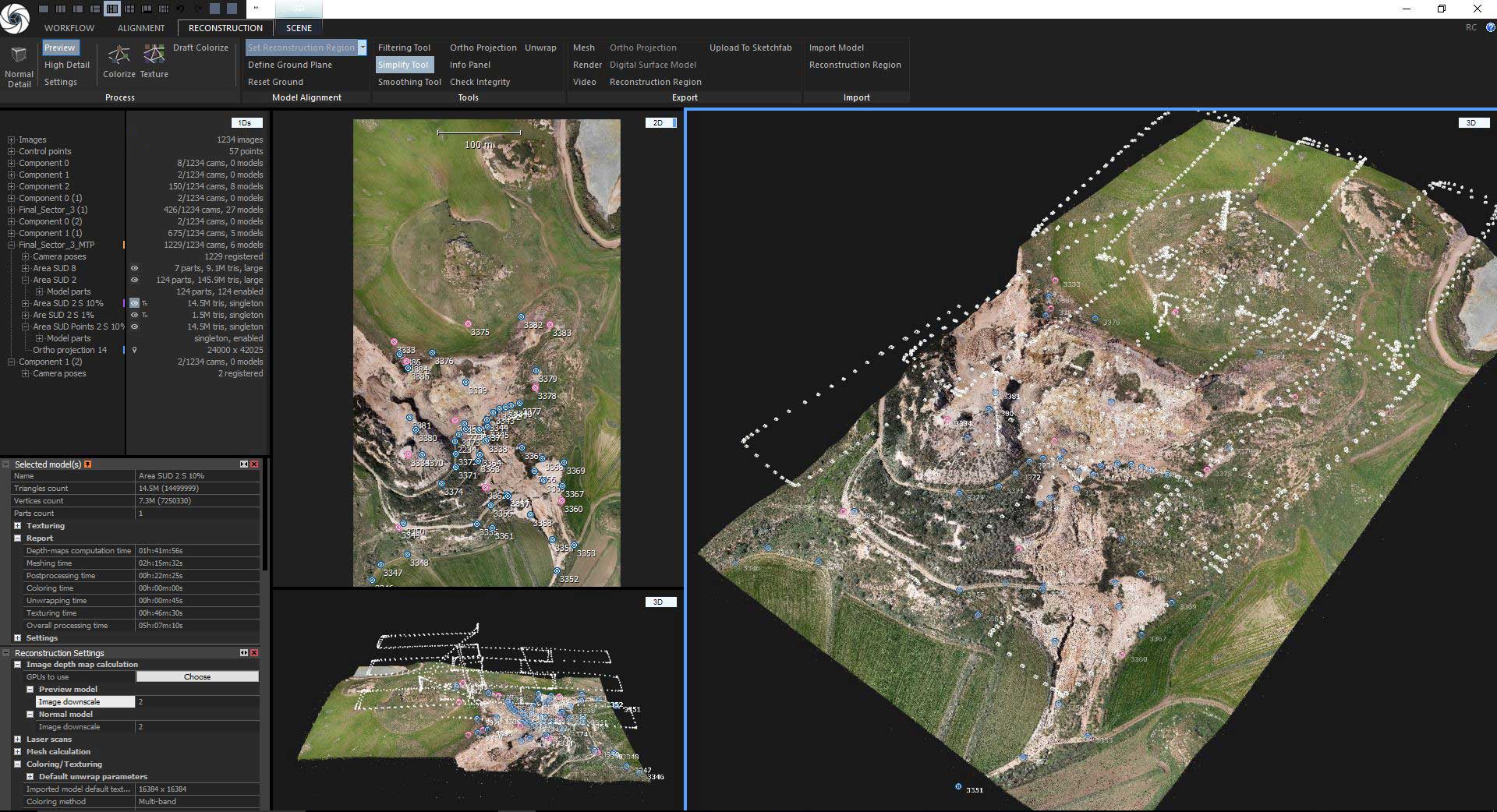
UAS was equipped with high-resolution digital sensors APS-C which allows to collect high-definition images. Thanks to RealityCapture they were able to process large scenes at a very consistent level of detail.
Result
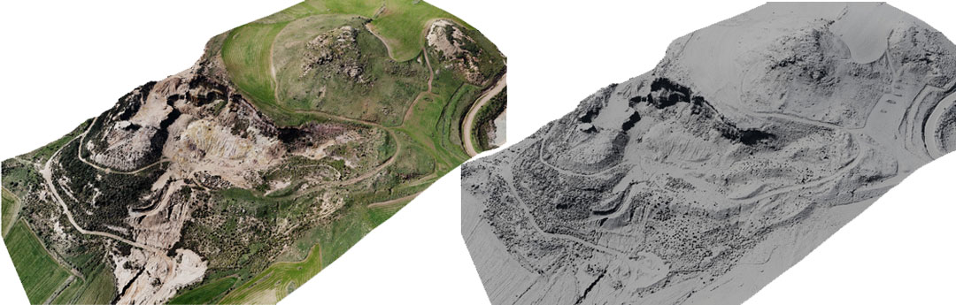
With their UAS systems, they are able to safely perform a quick survey of the areas, and with RealityCapture, which allows to manage heterogeneous image datasets, the results are very fast and accurate. Point clouds and structured meshes are comparable at different spatial scales for mapping of soils and vegetation coverage, geological outcrops, quarry walls, surface drainages, landfills, quarries, tailings accumulations, infrastructures, and for measures of volumes characterizing the area.