RealityCapture
Complete photogrammetric documentation of architecture
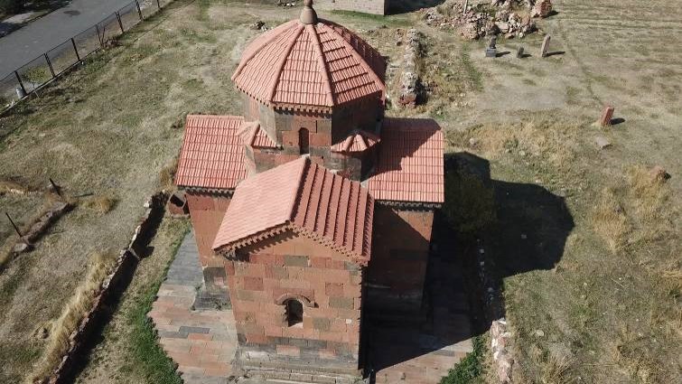
An example shown on a 7th century church located in Talin, Armenia.
Project „Hayastan“ is a Czech - Armenian archaeological expedition focused on preserving Armenian cultural heritage by using non-destructive methods of archaeological research (geophysical measurements, topographic - geodetic survey, aerial archaeology, etc) and modern methods of 3D documentation of important historical monuments.
Parties involved in this project are experts from organization Our History (Nase Historie) Academy of Sciences of the Czech Republic in Prague and Academy of Sciences of Armenia in Yerevan.
Given the Christian roots of the Czech Republic and the fact that Armenia is the oldest country to embrace Christianity as its state religion (301 AD), the attention is focused on the amazingly preserved Christian architecture.
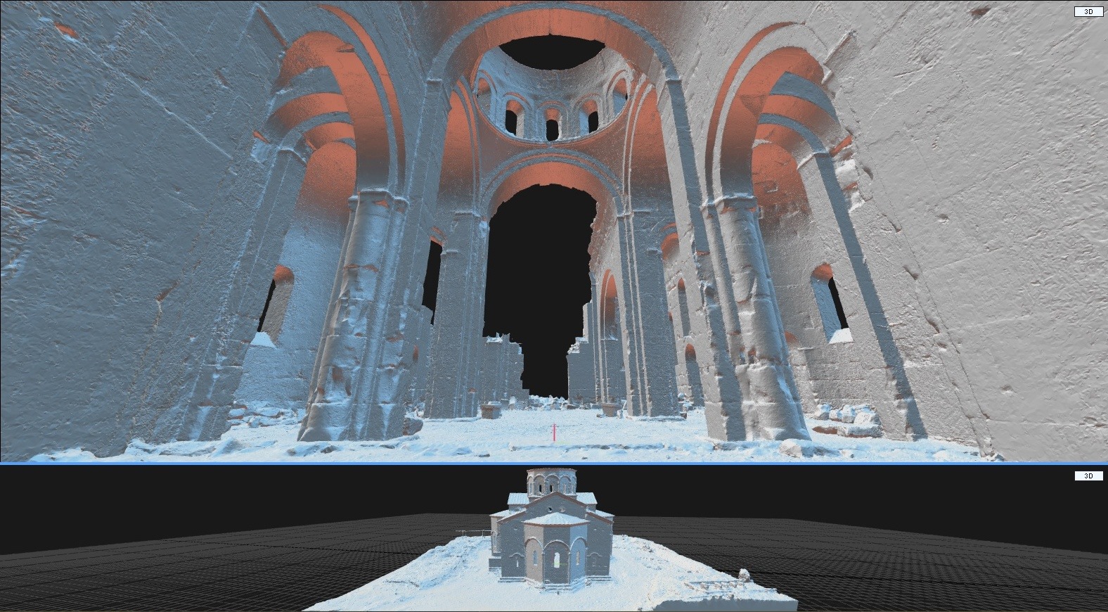
Both churches (smaller ones dedicated to Virgin Mary and Great Cathedral) are located near the city of Talin, in the province of Aragatsotn. In both cases, only photogrammetry (terrestrial + video from the drone) was used for 3D documentation. In fact, it has been proven that by using appropriate methods of the image capturing and by using robust software (RC), laser scanning can be completely replaced.
The exterior and interior of the building can be scanned very well and above all, very quickly. The high efficiency of this method is due to the low cost of technology and in the speed of gathering the data and creating the digital copy of the object of interest.
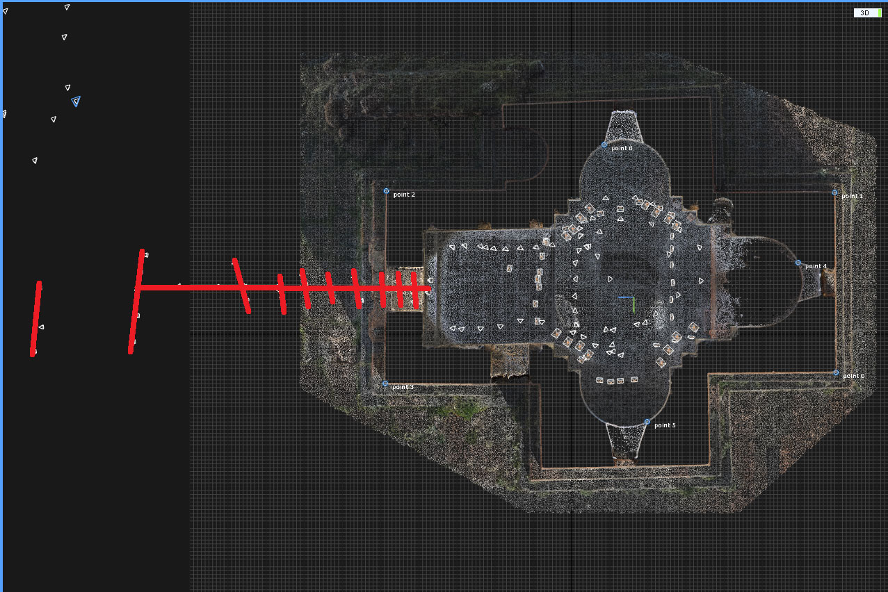
Models of both churches from Talin are georeferenced thanks to four ground control points. The control points are determined by the polar method. In the interior of the building, other control points were measured by using a polar method as well, which showed high accuracy (and correctness of the automatic connection of exterior and interior) of automatic calculation in RC.
Basic principles for precise geodetic documentation
Rules for taking images:
What is essential for photogrammetry is the quality of the input data and good camera. In this case the photos were captured by professional photographer Martin Frouz.
Basic principles:
- Correct position of ground control points
- Image capturing based on the flight plan – flights performed in grid
- Robust software for processing – during this project 4 different photogrammetry software have been compared and only RealityCapture enabled fully automatic calculation producing detailed and accurate result.
Accuracy check: methods used
- 4 ground control points were used in exterior for scaling and georeferencing
- 3 control points were used to check the quality of merging interior and exterior, measured with total station, polar method
The processing of data
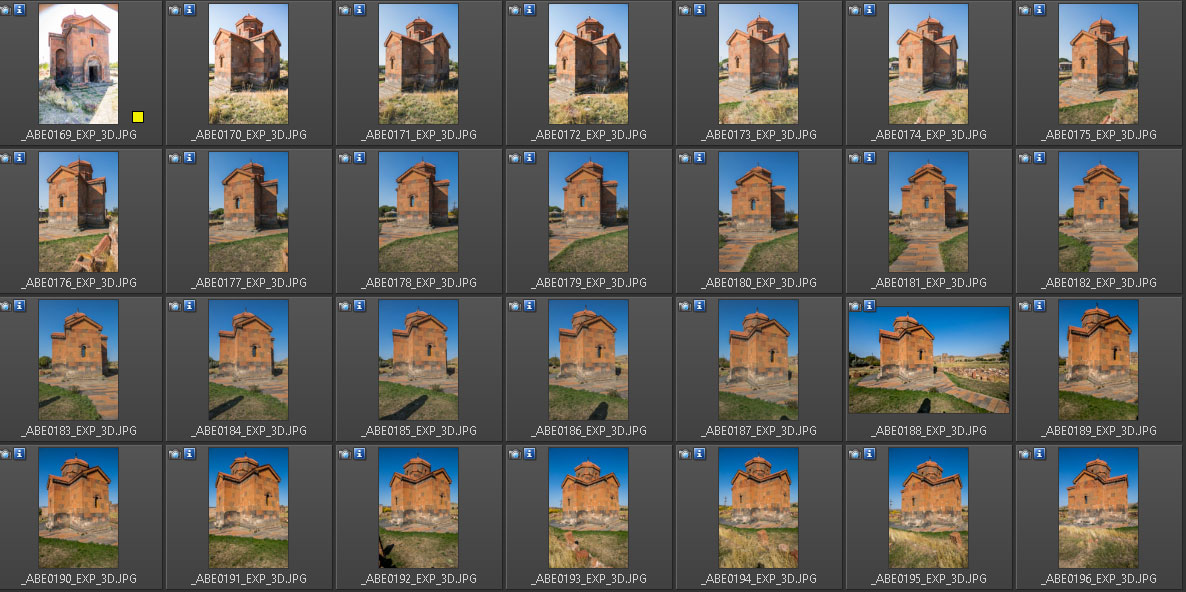
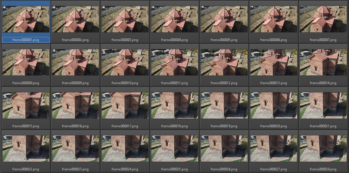
a/ 160 images of the exterior ( Canond EOS 5D Mark IV) The images were taken in raw format with 24mm lens.
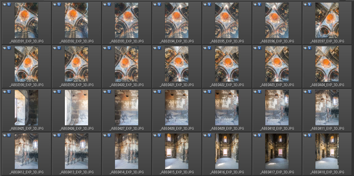
b/ 102 images of the interior of the church ( Canond EOS 5D Mark IV) The images were taken in raw format with – 31 images with 11 mm lens and 71 images with 24 mm lens.
c/ 2 short video sequences from drone for capturing parts inaccessible from the ground
Drone used: DJI Mavic Platinum
4K video shot at 30 fps – RealityCapture then created 523 images for processing
Note: When it come to quality of the resulting data, the use of video from the drone is not an ideal solution. It was chosen for two reasons: the size of the drone and the speed of data capturing. However, for capturing the inaccessible parts of the roof this data source was sufficient.
RealityCapture (RC)
From each tested photogrammetry software, the RC was the only software that produced detailed and accurate model fully automatically.
With other professional photogrammetry software packages the manual labor was required. Photogrammetry software for hobbyists produced high inaccuracy when merging interior and exterior - They didn’t fulfill requirements for geodetic documentation.
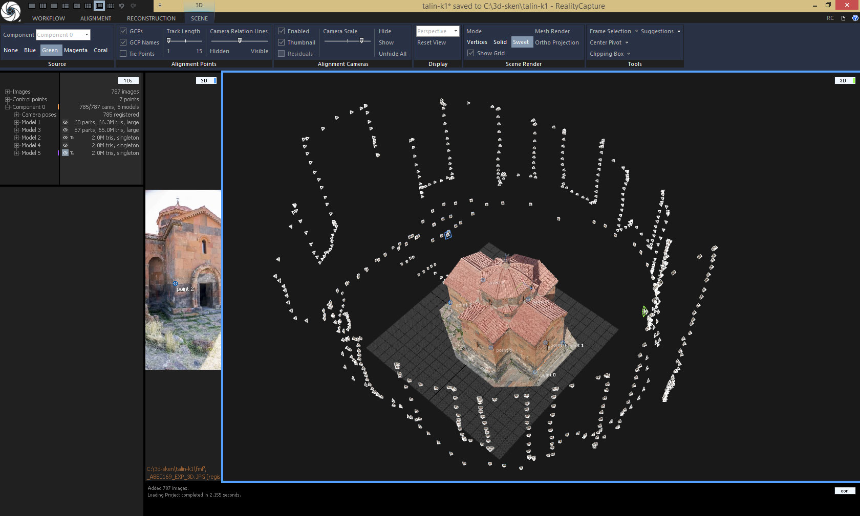
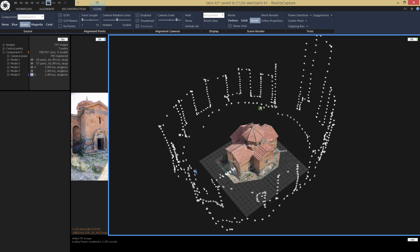
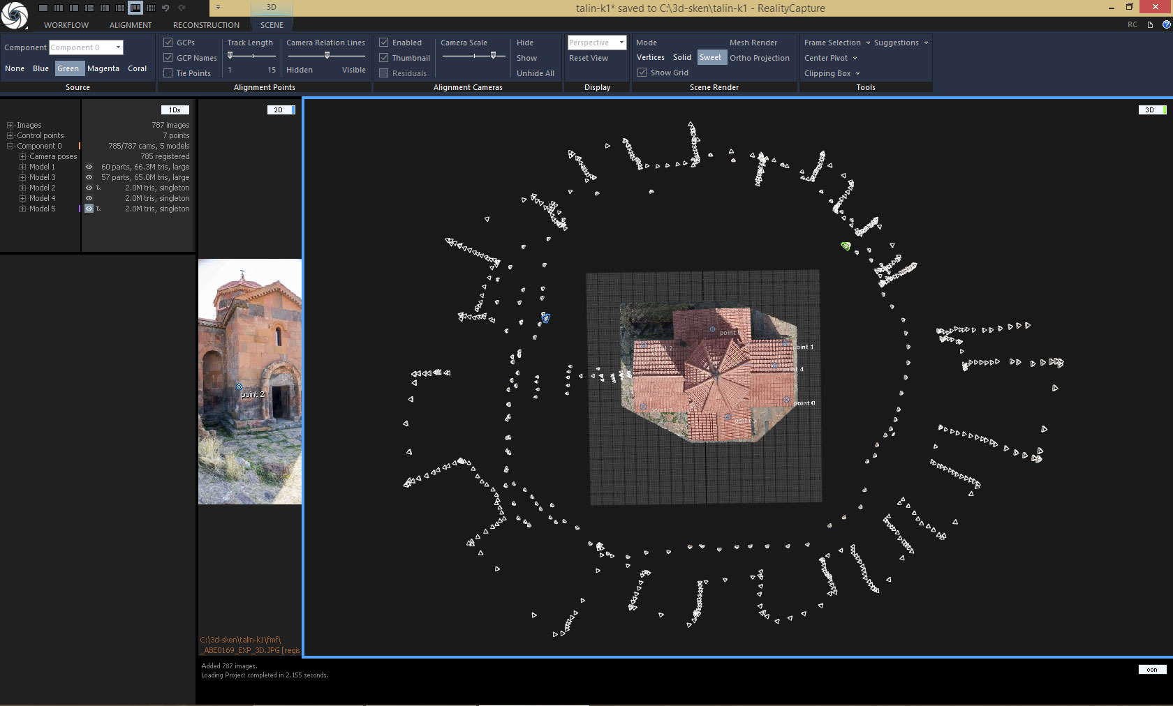
The position of the cameras shows the exterior capture method scenario. Flying with drone in as most regular grid as possible. The capturing method affects the quality of the resulting model and allows for additional or controlled stereophotogrammetric calculations. (Recommended photographic documentation methodology in archaeology for subsequent metric image analysis, Sindelar at al. 2019, Digital and digitized photography for scientific purposes in monument care practice, Bezdek, Frouz 2014)
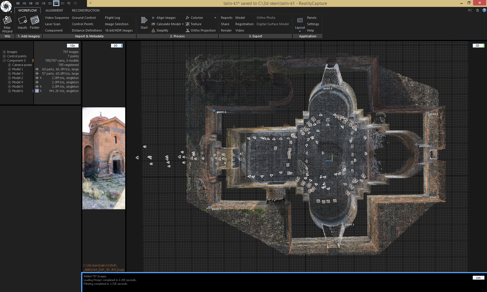
Position of cameras for calculation of interior and merging with exterior.
Optimal distribution of photography standpoints for automatic connection of exterior with interior.
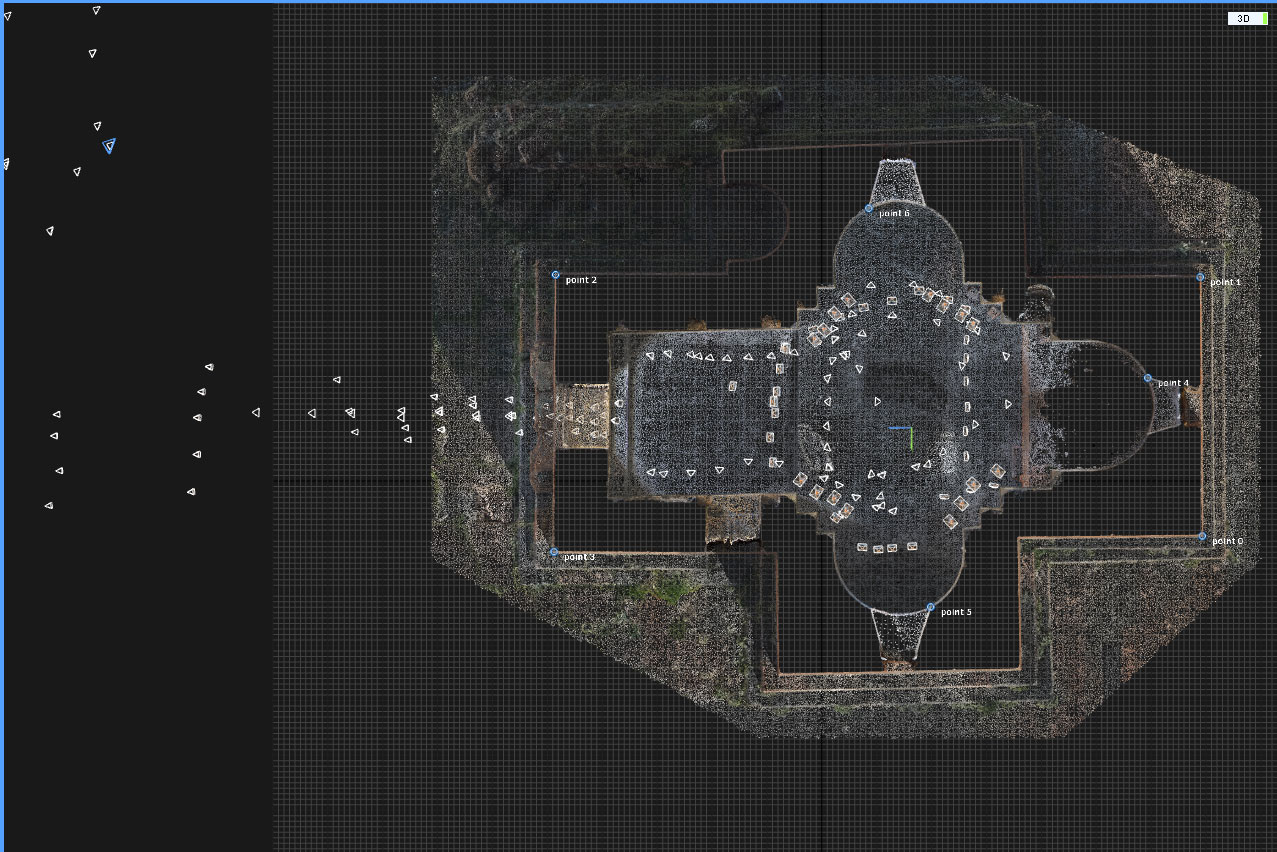
We move along imaginary lines and always take a series of images with a parallel axis of a scene - this enables better automatic connection through a small building opening and also a possible stereophotogrammetric calculation (in addition to a series of images with axis of capture perpendicular to the object, oblique, diagonal and frontal images are captured as well.)
Ground Control Points (GCPs)
For defining the scale and coordinate system of a scene, 4 ground control points were used on the exterior part of church and for automatic connection of interior and exterior 3 control points were placed in the interior (ground test was performed after the model calculation – hence, not for the RC calculation).
Finally, GCPs in local coordinate system measured with total station were used.
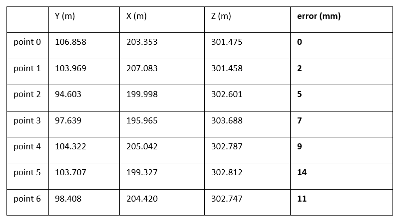
Table of coordinates of ground control points and the position errors after processing in RealityCapture.
Fully automatic processing in RealityCapture – alignment time – 20 min., meshing time – 1h. 6min.
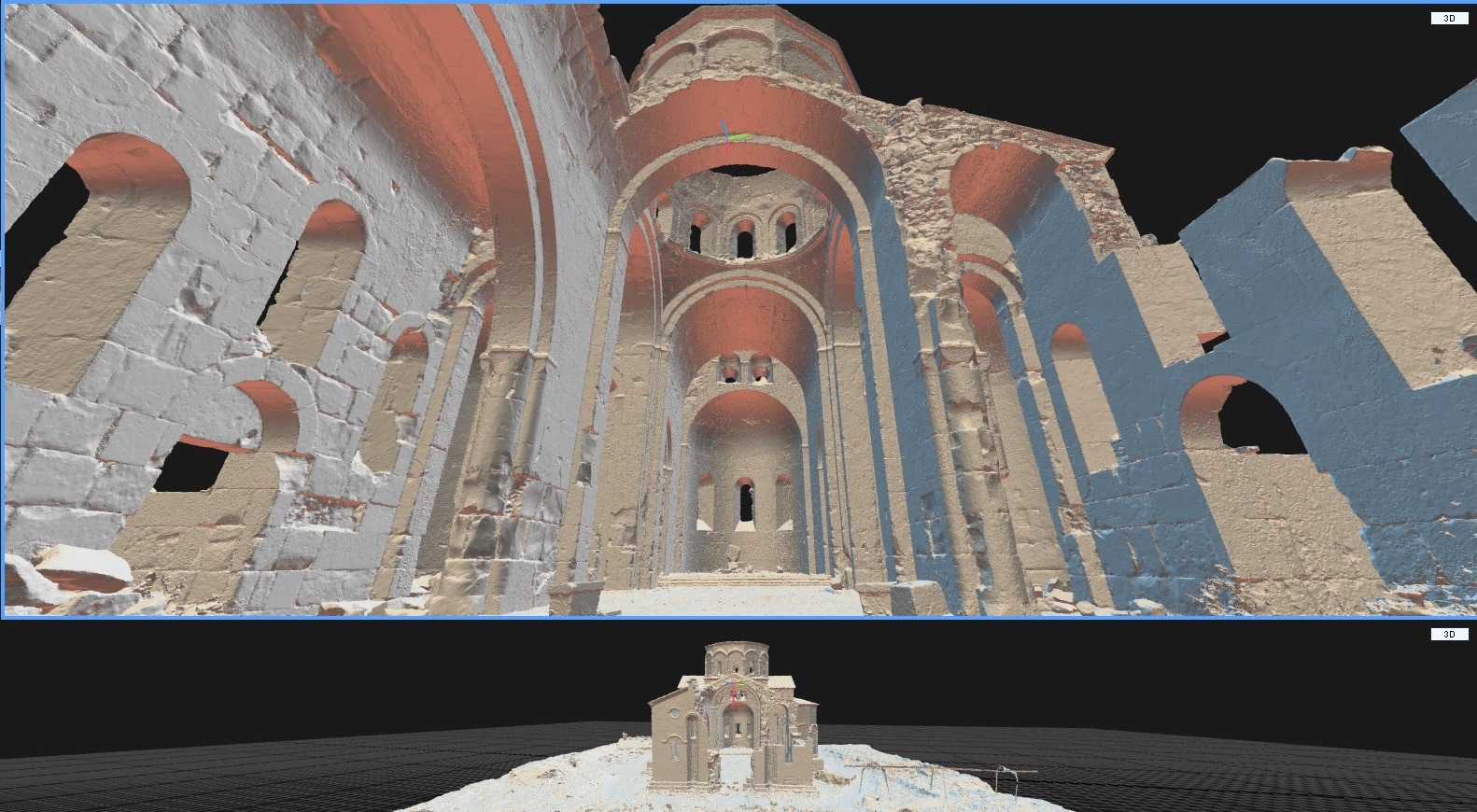
Final untextured mesh in RealityCapture