Perfect solution for mappers
Create 2D/3D Maps
RealityCapture is a perfect solution for your mapping projects. You can create infinite number of ortho-projections and maps. For each map, area and volume measurements are automatically calculated. Moreover, you can use several options how to geo-reference your map and with control point experience, you are able to create hundreds of measurements for ground control points within minutes.
Map Wizard
RealityCapture Map Wizard is basically one-click virtual assistant in a creation of geo-referenced maps and/or models.
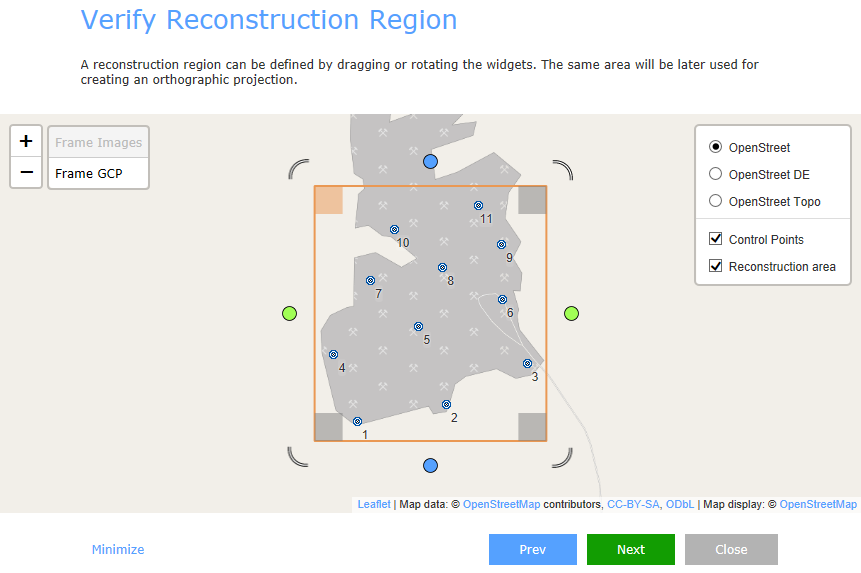
It is an easy and intuitive tool enabling you to have end-to-end results in one place.It works in few simple steps:
- Drag & Drop images or laser scans
- Import flight log, GCPs or CPs
- Define your goal
- Press GO and obtain geo-referenced map
Geo-referencing
RealityCapture enables you to use all different types of geo-referencing like:
- Flight logs
- GPS coordinates in EXIF
- Ground control points
Coordinate system mixing: Furthermore, each ground control point or camera can be in a different coordinate system.
Maps/DSM
It has never been so easy to create a map. Just define an area, select a coordinate system and press a button. Your map will be stored in the project and you will be able to export it anytime. You can export your map in the form of a "True Orthographic Photograph" or a "Digital Surface Model" into:
- Image file formats like JPG, PNG, TIF etc., including the world file.
- Google earth: KML/KMZ
- GIS software file format: GeoTiff
Arbitrary orthographic projections
You are not limited just to maps with your projects. You can create arbitrary orthographic projections and cross-sections.You can define the projection plane, size and rotation of the projection area and get the resolution you need. All ortho-projections are saved and can be exported as image, altitude or depth layer. This feature is very useful for project documentations.